China Announces It will Build Controversial 60GW Mega-Dam in Tibet
[ad_1]

After years of speculation, China last month announced it would build what it described as the world’s largest hydropower dam in its Tibet region—a $137-billion megaproject nearly three times the size of the Three Gorges Dam to be located on the Yarlung Zangbo River in one of the deepest gorges on earth. But the estimated 60-GW project has raised serious concerns from environmentalists and neighboring countries India and Bangladesh because the dam site is in an earthquake fault zone experts say.
Just two weeks after China announced the project on Dec. 25, the Tibetan region suffered a massive earthquake measuring 6.8 on the Richter scale that killed 126 people in the thinly-populated area and left 180 injured. The Jan. 8 quake was followed two days later by a major 5.5-magnitude aftershock. The epicenter is about 1,200 km from the dam site, but environmental advocates cite risks involved in constructing the project in a region that has seen a series of quakes in the past several decades.
China has rejected criticism about the risks involved in the project. “Let me reiterate that the decision to build the project was made after rigorous scientific evaluation and the project will not have a negative impact on the ecological environment, geological conditions and the rights and interests related to water resources of downstream countries,” Chinese Foreign Ministry spokesman Guo Jiakun told media.
According to the government, the dam will be built in the Yarlung Zangpo Grand Canyon, where the river makes a U-turn before entering India. It has a steep descent of nearly 2,000 meters over a 50-km stretch creating vast hydroelectricity potential. The project would include one or more 20-kilometer-long tunnels necessary to divert the river’s flow.
“The project raises concerns about the risks of flooding and structural collapse, particularly in the event of an earthquake. The project is located in the vicinity of the world’s deepest gorge, which poses unique geological and engineering challenges,” Neeraj Singh Manhas, special advisor for South Asia at South Korea-based think tank, Parley Policy Initiative, told ENR.
He said the region is highly seismically active due to tectonic interaction between the Indian and Eurasian plates in the earth’s crust. “A large-scale hydroelectric project in such an area must contend with the potential for earthquakes, landslides and glacial lake outburst floods, which can all compromise dam integrity,” Manhas said.
The Yarlung Zangbo River flows from China to India and Bangladesh while merging with other rivers to become the Brahmaputra, which has led the governments of India and Bangladesh to express concern.
“The Chinese side has been urged to ensure that the interests of downstream states of the Brahmaputra are not harmed by activities in upstream areas. We will continue to monitor and take necessary measures to protect our interests,” Randhir Jaiswal, spokesperson for India’s Ministry of External Affairs, said in a statement.
After the quake, China’s Ministry of Water Resources said it had carried out inspections and found that the event had no impact on any existing dams and reservoirs in the Tibet region, which has 68 structures that tap hydroelectric potential of high-altitude rivers and lakes.
‘World’s riskiest project’
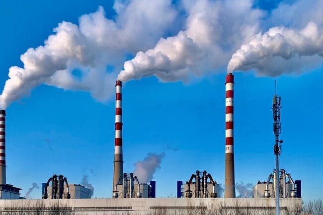
China is interested in the project to replace pollution-causing coal-sourced energy, seeking cleaner sources such as hydropower, as well as nuclear and solar energy, observers say, but they are not sure if Beijing will be able to sustain the investment when it is facing an economic slowdown.
“This is possibly the world’s riskiest project, and a serious engineering challenge to build and maintain,” Himangshu Thakkar, coordinator for South Asia Network of Dams, Rivers
and People, a Delhi-based research group, told ENR. “I think the Chinese government would not undertake such a foolhardy project. If there is a disaster, a part of China would also be affected apart from downstream places in India and Bangladesh.”
Engineers entrusted to build the dam would face a major obstacle in the form of a frozen lake called Sedongpu located a few dozen kilometers upstream from the construction site. Created by a landslide in 2018, it is like a colossal tank hanging above the dam site.
The government has sent several groups of scientists and engineers in recent years to determine how to get rid of the artificial dam. “The situation is very difficult. There is not an immediate solution yet,” said Xing Aiguo, a civil engineering professor at Shanghai Jiao Tong University, who was involved in one of the studies, in a report by Hong Kong-based South China Morning Post. The expert teams also reported climate change impacts may lead to similar disasters resulting in formation of more lakes. “The area is large and there are many glaciers,” he said.
Development of natural resources and energy in the Yarlung Zongpo River “must fully consider” risks of avalanches and debris flows in the Sedongpu valley, said a 2019 Ministry of Natural Resources report. The UN Intergovernmental Panel on Climate Change found that 25% of glaciers on the Tibetan Plateau have disappeared since the 1970s, and two-thirds of those remaining will be gone by the end of the century.
China has been often criticized for building 11 dams over the cross-border Mekong River that are believed to have caused severe droughts in neighboring Vietnam, Laos and Thailand. “China has no water treaties with neighbors who share common rivers. It always acts on its self-interest without bothering how its dam projects would impact life in other countries,” Thakkar said.
China’s foreign ministry defended the Yurland Zangbo project, emphasizing that it “will not negatively affect the lower reaches,” spokesperson Mao Ningshe said, adding that the government “will continue to maintain communication with countries [there] through existing channels and step up cooperation on disaster prevention and relief” for people affected.
[ad_2]
Source link
Post a Comment
You must be logged in to post a comment.


